Contact information
Name:
John Clark
Phone:
610-330-5903
Email:
clarkjh@lafayette.edu


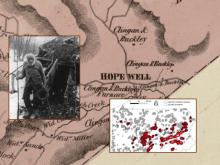
In reconition of World GIS Day Dr. Ben Carter (Muhlenberg College) will discuss the role of Geographical Information Systems in identifying the role of landscapes in the Underground Railroad. Using remote sensing, machine learning, field survey and an array of historical documents, he will demonstrate the ways in which the "charcoal lands" around Hopewell Iron Furnace, Berks County, PA were deployed by small, rural Black communities and their abolitionist allies to assist those liberating themselves from enslavement in the American South.