Contact information
Name:
John Clark
Email:
clarkjh@lafayette.edu


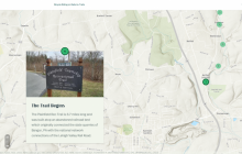
The ArcGIS Story Maps application is a user-friendly online platform for creating narrative exhibitions. It is available, through subscription, to the entire Lafayette community. Digital story-telling with maps allows users to link a variety of text and media to the locations and events that frame their narratives in a professional online application.
Zoom link: https://lafayette.zoom.us/j/93437699098