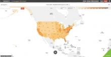
The web is rich in online GIS projects which allow us to explore research results in maps while controlling certain parameters in our browsers. For instance many projects are designed to tell a story with maps while allowing users to manipulate the time frame or the types of data mapped. In addition there are a number of GIS sites, called data portals, which allow users to search a map interface for geospatial data which they can use for creating their own online maps without resorting to cumbersome GIS software. Participants will be introduced to one such portal, Social Explorer®, a socio-economic database available to the Lafayette community through a subscription at Skillman Library. Following a map making exercise using this site we will explore other scholarly web GIS projects, focused largely on historical research. No GIS experience or knowledge is necessary to enjoy this casual exploration of online mapping. Windows laptops will be provided for all participants, but feel free to bring your own.
Lunch provided. 18 seats available. Please RSVP by Friday October 24 to John Clark, Data Visualization & GIS Librarian - clarkjh@lafayette.edu


